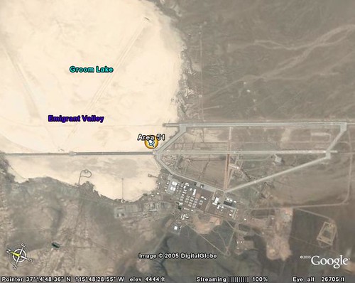
 to get the whole of the runway in the "frame" I had to "view" the site at 26705 ft.
Below is the runway of RAF Wyton which is a RAF station that has a fairly long runway and not far away from where I live.
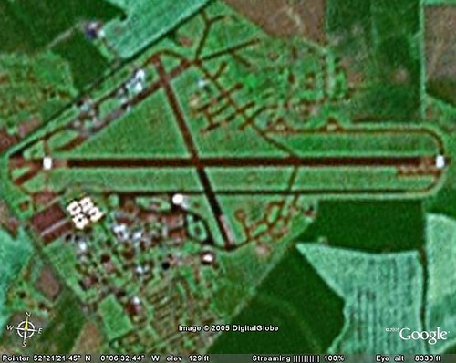 RAF Wyton's runway is 2516 metres long and to fit it into the frame I had to view it at 8330 feet.
 Wow Area 51 has one hell of a long runway. That's all I'm saying.


Which is strange, when you think about it. UFOs go straight up. :-)
ReplyDeleteCant wait for a mac version.
ReplyDeleteHave you checked out maps.google.com because they are good. My house is just outside the saterlite zone though :-(.
have to agree with Becky though !
Becky, who says all UFOs go straight up?
ReplyDeletePF ah for once we PC users have the upper hand. This is way better than google maps not that I'm crowing or anything
Area 51 needs the long runway for many reasons. First and foremost, before Google Earth the Russians had spy birds. Having a short runway would tell them that whatever top secret plane we were flying did not need much room to take off.
ReplyDeleteBy making the runway very large, there is no way to tell what is flying, what the take off speed is, or how fast it can take off. In other words, can the newest top secret aircraft take off and land on a 1/4 mile (or say 500 meter) stretch of road? Maybe, maybe not. Who knows.
But what I would like to do is get on that runway with a 550 HP Dodge Viper.
Oh Iggy, never let the truth get in the way of a good conspirisy theory!
ReplyDelete